PRO
jp15sil24
Germany
Asked
Map Loading And Wavefront Inquiry
,
Do we currently need to manually load an occupancy grid or map into the Synthiam ARC software, and if so, what is the procedure for doing this? I have noticed that the robot skill does not have a settings user interface, as the 3-dot menu doesn’t open any configuration options.
Additionally, is the Wavefront robot skill fully developed and functional at this point, or are there still features related to map loading and configuration that are in development?
Related Hardware (view all EZB hardware)
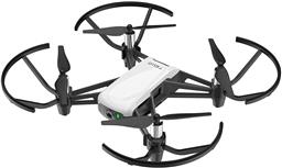
Adventurebot
by EZ-Robot
Two-wheeled WiFi robot with camera using EZ-B v4 brain-affordable, expandable AdventureBot kit built from EZ-Bits, sold by EZ-Robot.
Wi-Fi / USB
Servos
24
Camera
Audio
UART
3
I2C
ADC
8
Digital
24
Related Robot Skills (view all robot skills)

Wavefront
by rz90208
Wavefront grid planner computes collision-free, deterministic paths from start to goal using known occupancy maps for indoor robots.
Requires ARC
v2

EZ-SLAM
by Synthiam
Creates a map in a global variable; proof-of-concept SLAM visualizer (very experimental).
Requires ARC
v25

Short answer
What Wavefront expects (important)
How to load a map into ARC (three recommended ways)
Notes about that script:
Why the Wavefront skill has no settings UI
Is Wavefront "fully developed"?
Pointers and links
Next steps - how I can help you now
Tell me which option you'd like and what map format/data you already have, and I’ll provide the exact script or stepbystep instructions.